Thursday, January 24, 2013

Christmas Holiday 2012 - final instalment

After our previous adventures in the Mt Aspiring area we found that the weather forecast looking forward was pretty rubbish. We had organised a cheapo flight from Makarora into Siberia with the view to doing some climbing in the area. With heavy rain forecast that idea went out the window and we headed to the DOC office to figure out our alternatives. It seemed that most of the South Island was about to be drenched so we made the call to head to where the rain would potentially be the worst - Fiordland! What the heck?!?!

We spent a soggy night camping at Makarora.


In the morning we packed up a damp tent and started the drive from their, past Wanaka and Queenstown to a lodge down by Lake Monowai (south of Manapouri. Once there we checked in with the manager of the Borland Lodge who informed us that the topo map for the area was incorrect and that a bridge marked on the map didn't exist. With the forecast rain we realised we would be able to make it through to North Borland Hut but that we would have to wait for the river flow to reduce before we'd be able to make it back out again. So we packed up plenty of food and headed up the North Borland track. As it was late in the afternoon we stopped for the night at a rock bivvy. The bivvy had a wooden platform for sleeping on. Due to the large number of sandflies we pitched the inner of our tent on the platform.

Rock bivvy
The following morning we carried on along the track to North Borland Hut. On the way we crossed the mid branch of the Borland River and took note of the waterflow. This was the river that didn't have a bridge on it and the river catchment area was huge so would definitely flood.
Mid branch of the Borland River looking very serene

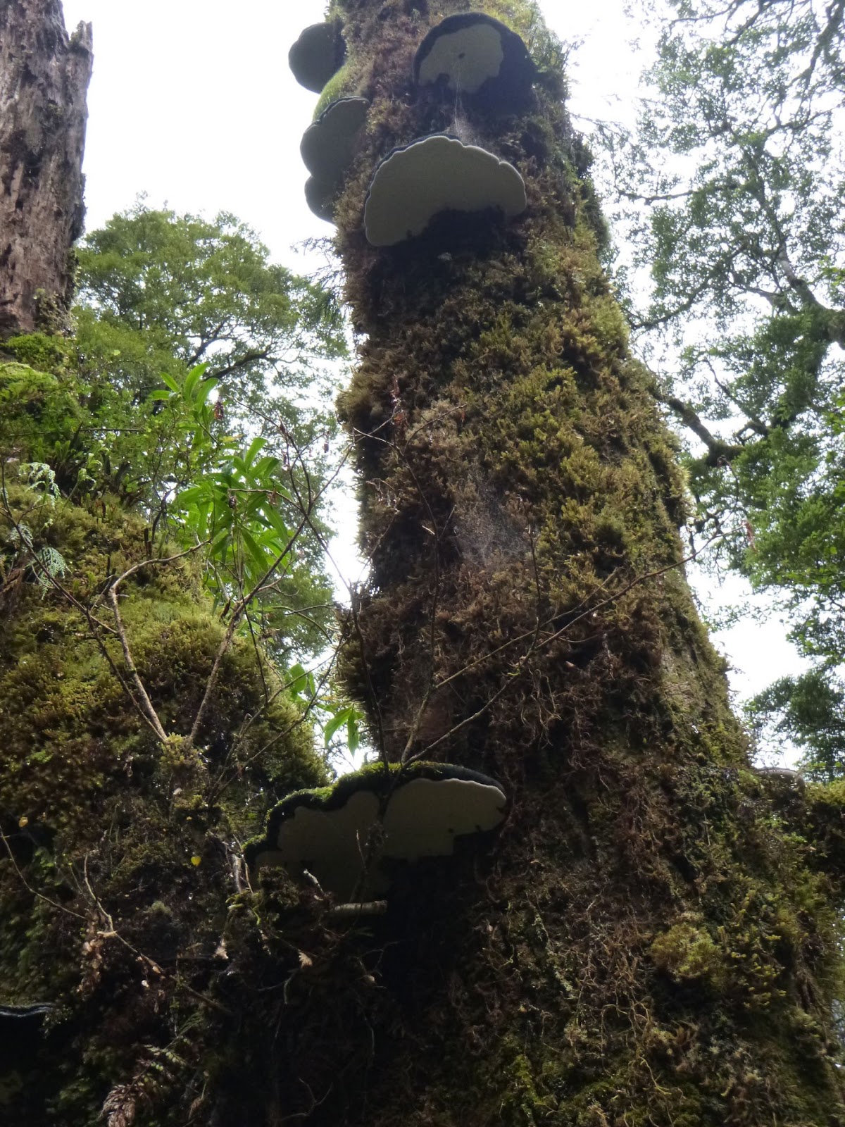
Typical bush - loads of moss due to the general wetness


After a few hours we reached the North Borland Hut which would be our home for the next few days. The hut is a 2-man basic DOC hut. There's an open fire, a bunk, a kitchen bench, a wooden bench for sitting on and a long drop out the back towards the trees. Unfortunately the roof leaked so the top bunk was out of commission during our stay. Two of us scrunched into the bottom bunk made for some cosy nights.
North Borland Hut
Inside North Borland Hut
   
Borland River - before the rain


View from the side of the hut looking across the river (now in flood)
During the night we got to the hut it rained. A lot. On checking the situation through the night we realised that surface flooding had resulted in the hut being completely surrounded with water - close to knee deep in places. We made sure to lift all our gear off the floor during the night just in case the water came through the floor. Due to pretty much constant rain, the next day was spent lounging around in the hut. We read and did Sudoku puzzles for the day. It was still raining on the following day but we decided to head off for a walk further up the valley anyway. We stuck to the true right of the river heading up the valley which made for some interesting bush bashing at times. Further up the valley we managed to cross the river so returned to the hut on the other side of the river. On the way we found a established campsite including a grave (maybe a mock one?) pictured below. The grave was complete with the toes of a pair boots protruding through the soil.

Grave at campsite
We walked back to the hut and managed a safe crossing of the river. After a good hunt around for firewood we settled in for the rest of the evening and night. We'd been back for a short period of time when we noticed that all the hills around us had a good layer of fresh snow. That would explain why it was a little chilly. Luckily we had done a good job collecting firewood.

Snow on the hills opposite the hut

The following morning dawned quite a lot brighter and we had hopes of getting in some climbing. Unfortunately there were still showers coming through and we had no up to date weather forecast so made the sensible, although frustrating, decision to head back out to Borland Lodge.

View from a high point on the track

Lunch spot on the way back to Borland Lodge
When we got out to the lodge we arranged to stay in one of their chalets for the night. When it came to dinner time we decided to head up to Manapouri for a meal. The options were pretty limited but we had ourselves a tasty meal of flounder and salad before heading back to the lodge.

The following morning saw us heading north towards Queenstown. We figured we had time for one last adventure so drove up to the Remarkables Ski field, packed our gear up and got walking. The plan was to walk up the ski field, climb over the saddle to the other side of the range and bivvy for the night by the tarns at the top of the Wye valley.

View from the carpark looking up the skifield


On top of the saddle

View from the saddle looking down to the tarns
View from close to our bivvy site looking down the Wye valley
It was extremely windy and cold so we built a rock bivvy to give us some shelter from the wind.

  
Our DIY rock bivvy
During the night the wind eased and the sky clearer. The clear sky was amazing with the stars looking very close. In the morning we packed up and headed back down to the skifield carpark before getting on the road to Christchurch where we would catch our flight home to Wellington. After three weeks of tramping, climbing and camping we were just getting in the groove so it was a bit sad for the adventures to be over.

Lake Pukaki

Lake Pukaki with Mt Cook in the background

Campsite close to Christchurch for our last night

Wednesday, January 23, 2013

Christmas holiday 2012 - part five

On the morning of the 27th December we packed up and started walking up to the Quarterdeck on our way to Colin Todd Hut. It was another fantastic day weatherwise although the forecast for the following day (summit day) was not looking too flash.

Part way up French Ridge heading to the Quarterdeck

How's that for a view - Aspiring far right, Mt French to the left of Aspiring

Part way up the snow towards the Quarterdeck we stopped for a discussion about our plans. With the weather forecast the way it was coupled with the late night we had getting to French Ridge Hut it seemed unlikely that we would summit Mt Aspiring. While this was a great disappointment to us we decided it was better to look at this trip as a learning experience and to change our plans. We decided to dump our (super-heavy) packs and climb Mt French instead. We buried our packs in the snow to deter the keas from ripping them to shreds and headed off to climb Mt French.

Heading up to the Quarterdeck

View back down French Ridge

Mt French

Mt Avalanche in the background
A little crevasse we passed (stepped over)
After reaching the summit of Mt French we headed back down to collect our packs and return to French Ridge Hut. We stayed the night and then headed back down to the Matukituki Valley.
View from below French Ridge Hut back down to Aspiring Hut
As it transpired the weather the next morning was less than favourable and deteriorated through the day so the decision to not press on to Colin Todd Hut and the summit of Mt Aspiring was a good one. We'll be back in the future to achieve that particular goal and will be a little better prepared next time round.

Christmas holiday 2012 - part four

So, it's Christmas Eve, you just finished walking the Milford Track the previous day, the sun is shining and you're in Wanaka. What do you do?

Go walking of course!

We drove out to Raspberry Flat and walked up the Matukituki Valley for a day walk. The weather was perfect so it was a hot walk with little cover from the sun.
Matukituki Valley

Matukituki Valley

The track goes past the turn off to the Rob Roy Glacier pictured below.

Rob Roy Glacier

Rob Roy Glacier
Luckily we managed to find a shady spot to have our lunch. After lunch a couple of us carried out to Aspiring Hut which was another 15 - 20 minutes further on up the valley. In the photo below, the peak in the background on the right is Mt Aspiring.

Aspiring Hut


Aspiring Hut
Mt Aspiring from Aspiring Hut
After a long hot walk we had a swim in the Matukituki River down by the carpark before heading home and out for dinner.

Christmas Day was a perfect, scorching day in Wanaka and Queenstown with most of the day spent driving to Queenstown and back again.

Boxing Day was the day we set off for our climb on Mt Aspiring. We retraced our steps from Christmas Eve and headed up the Matukituki Valley but this time carrying heavy packs with our climbing gear. I made the decision to walk in wearing my climbing boots - that's a mistake I won't make again. Despite taping my feet I developed large blisters on my heels making the walk less than enjoyable. The plan for the first day was to walk up to French Ridge Hut. That involved walking up the Matukituki, past Aspiring Hut, across the river and then up the hill to the hut. On the surface that seemed like a simple, achievable plan. In retrospect, starting to walk in after 3pm wasn't the smartest choice.


From the valley floor we had a great view of French Ridge. The first part of the walk up to the hut is through bush. That was ok although some parts of the track were pretty rough and steep. Rest breaks were certainly needed.


After a while we came out of the bush into open tussock. At this point the sun was starting to go down and we were getting pretty tired. The weight of our packs didn't make the walk easy at all.

The photo below was taken as the sun was going down.

Mt Avalanche
We finally reached the hut at around 11pm. There were two other people asleep in the hut so we quietly had a snack (too tired to eat a proper meal) and got ourselves to bed. Tomorrow would be another hard day with the plan of climbing up to the Quarterdeck, crossing the Bonar Glacier and getting to Colin Todd Hut to position ourselves to summit Mt Aspiring the following day.
French Ridge Hut the next morning

Tuesday, January 15, 2013

Christmas holidays 2012 - part three

This post will cover off our time on the Milford Track. We were booked in to start the track on the 19th December and finishing on the 23rd. The weather forecast was looking decidedly iffy so I resigned myself to spending four days of walking in rain. The day we started the weather was brilliant so we drove to Te Anau Downs and caught the boat to the beginning of the track.

On the boat from Te Anau Downs.


The first day of the Milford is super-short - only an hour to get to Clinton Hut from Glade Wharf. The walk is all flat and mostly in the bush. We had a very brief swim in the Clinton River - brief because it was icy cold and the sandflies were rampant!

That night it rained pretty heavily and it was still a little drizzly the next day. We set out with jackets on etc but were able to dispense with those after a while and the day turned out just right for walking. The positive aspect of the overnight rain is that it kicked a lot of waterfalls into action. At first the waterfalls provided excitement but after the first 20 or so they all looked a little the same. Anyway, the day's walking was pretty cruisy and the scenery was fantastic.


Some cool looking fungi


Clinton River

The second night is spent at Mintaro Hut which is about 6 hours walk from Clinton Hut. We arrived at the hut, dumped our gear and headed up to Lake Mintaro for another very brief swim. Very refreshing! The keas cause quite an issue at Mintaro Hut. The hut has a policy that boots are not to be brought inside but the presence of keas there means you need to tie your boots together and then suspend them from a hook. This stops then ripping them to shreds in the night. All other gear must be brought into the hut to prevent damage.

The next day was the most strenuous of the walk (but was still pretty easy going) as you walk up to the top of Mackinnon Pass and then down the other side to Dumpling Hut. It's a 6-7 hour walk. The weather started out a little grey but improved through the day.


View at the top of Mackinnon Pass

Tarn on Mackinnon Pass

View on the way down from Mackinnon Pass


The photo below is of the Sutherland Falls. There is a side track that takes you closer to the falls but a slip that occurred last October has closed that track for the season. You can see the slip in the foreground. There is a still an area of loose rock near the top that DOC thinks could fall at any time. 


Our last day on the track was a gorgeous day. We made an early start to catch the first boat to Milford but had plenty of time for the walk, to stop and take photos, have a lunch break and then a swim at the end.

Arthur River


The end!

This is the slip that blocked the road out of Milford last year. They are still working on stabilising and clearing the slip. The road gets closed every night at present and also when it rains heavily.


Phew. What a long post. And tons of photos. There are still two more weeks of our holiday to cover so a few more posts to come.