Tuesday, January 24, 2012

Wellington Anniversay Weekend 2012

With the opportunity of a long weekend to have some fun on, we headed up to Kuratau on the Friday night after work. We had spent days looking at the weather forecast and it looked like Saturday was the best weather day so that day was chosen for completing the Tongariro Crossing (with the kids). We drove to the end of the track and caught a shuttle to the start of the track. It was an early start (after a late night) as we were meeting the shuttle at 7am. Bleary-eyed we were dropped off at the Mangatepopo car park at 7:45 and were quickly underway (with hundreds of other people).

This walk is one of the most popular in New Zealand and it is normal for over 1000 people to walk the track each day during the summer months. The walk itself is 19.4kms long and it's estimated to take 6-8 hours to complete. It's not a difficult walk for anyone with a reasonable level of fitness. One positive is that you tend to complete all the uphill parts in the morning and the rest of the day is spent descending. The walk starts off with quite a flat walk and then you climb the Devil's Staircase. That name made it sound daunting but it was simply a series of steps and climbs to reach a plateau.

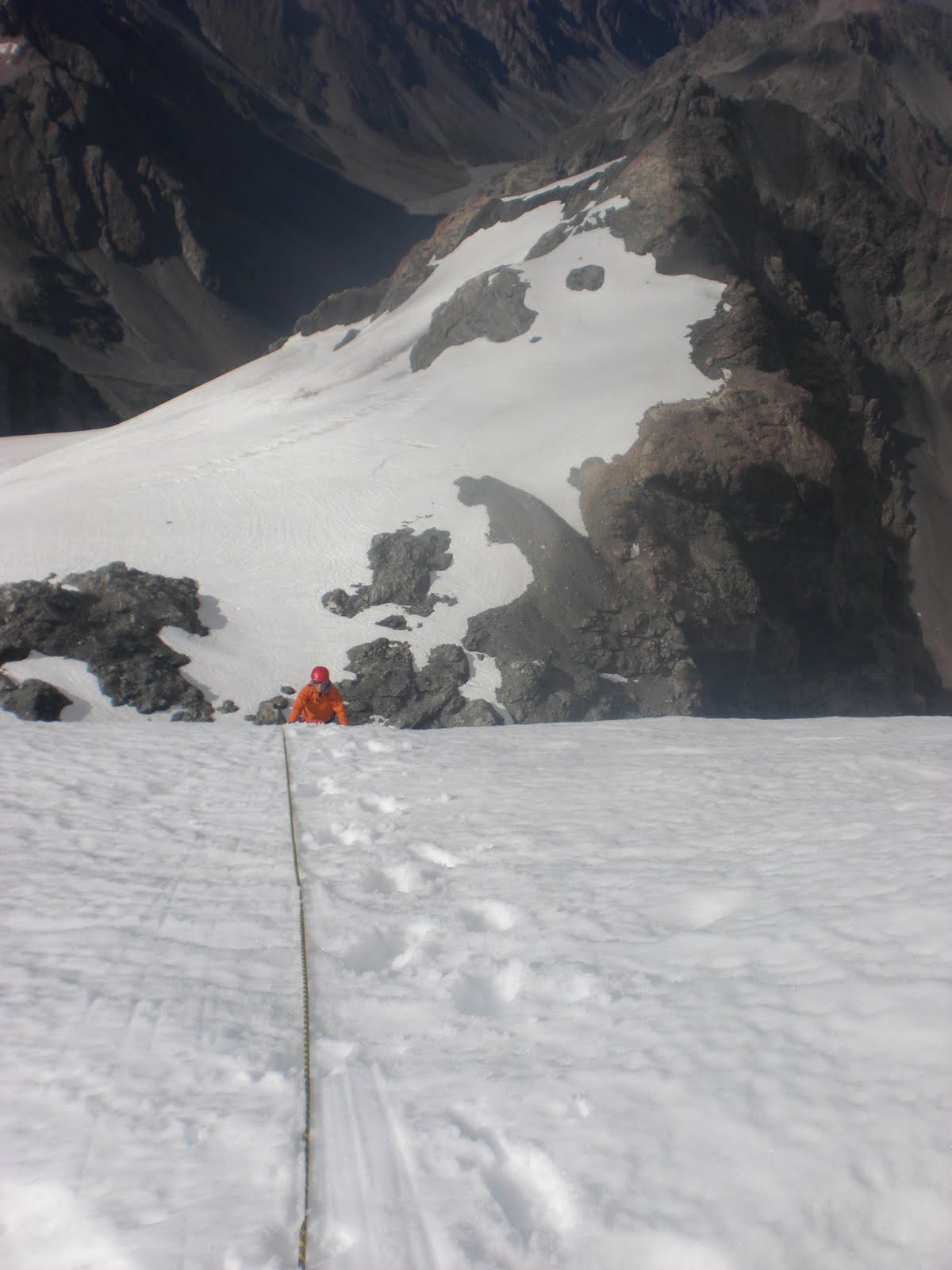
Once on the plateau we made the choice to deviate from the main walk and climb to the summit of Mt Ngauruhoe. This is a steep climb and there is a lot of scree. Plenty of people were making hard work of the climb going up the scree slopes but we made the choice to traverse across to a rock ridge which took us the majority of the way.

Once up the main climb the majority of people headed straight for the crater. We had carried out some research and realised the crater isn't actually the summit so we initially ignored the crater and walked to the summit itself - past an active steam vent. Here I am at the summit (it was a little windy and quite cold!).


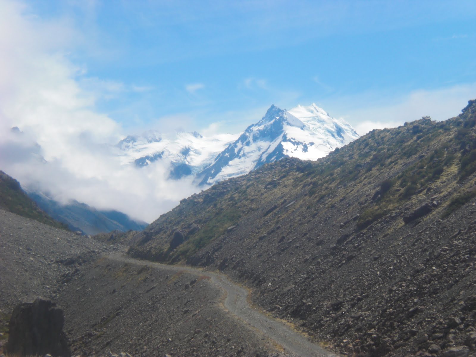
The view from the summit was awesome. We had a clear view across to Mt Ruapehu as well as a stunning view of Mt Tongariro and the Blue Lake itself.


After the obligatory photo session at the summit, we descended a bit before climbing up to the crater. The volcano itself is considered to be one of the most active in New Zealand and it has tended to erupt every 9 years or so historically - although the last time there was any significant activity was in 1976.

The cold wind was getting annoying so we descended back down to the main Crossing track and found a sunny spot for a lunch break. The descent was a lot of fun as we ran straight down the scree slope. It only took 20 minutes to get back down. Here is the view looking back at Ngauruhoe with Ruapehu in the distance.

After lunch we carried on walking to the Red Crater then the Emerald Lakes.

After another quick break at the lakes we continued with the descent back down to the carpark.

All up, the walk took about 10 hours including the diversion up to Mt Ngauruhoe. That was pretty good time considering we had a 6-year-old and a 9-year-old along for the trip.


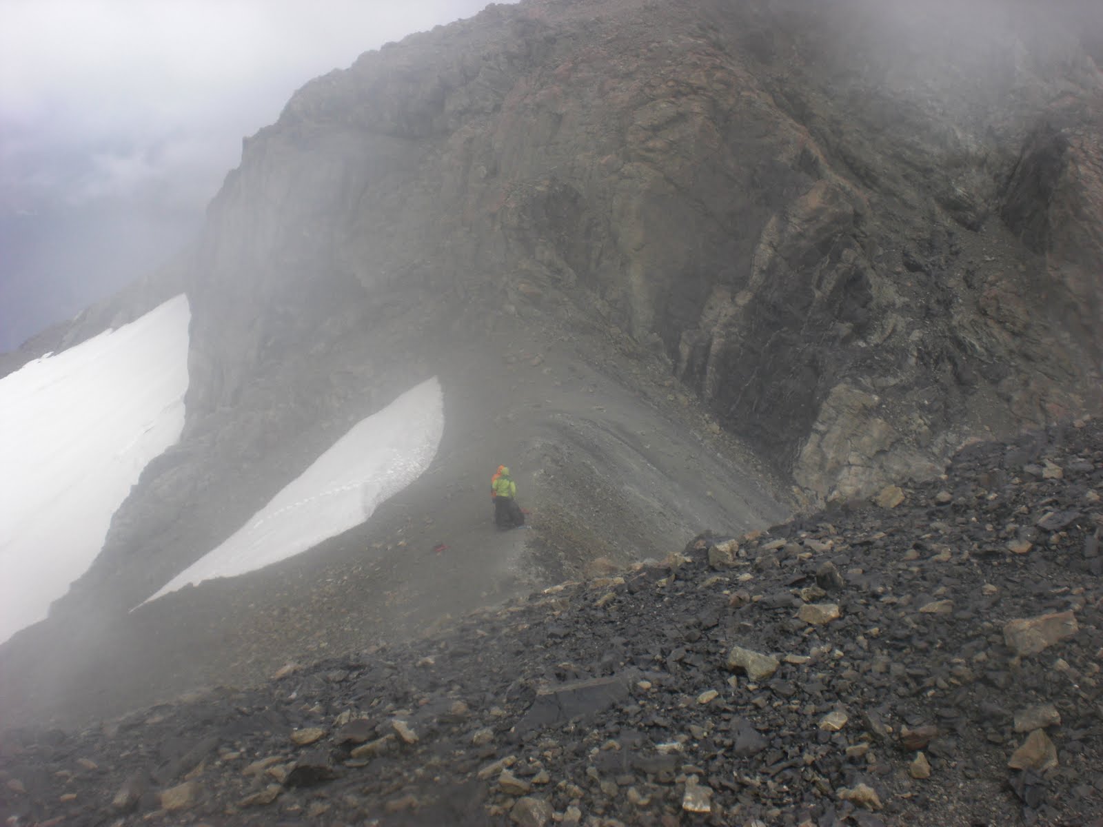
You definitely need to pick your day to do this walk. Even if it seems to be a perfect day you should still go fully prepared with food, water and plenty of warm clothing (and sunscreen). It's common for the weather to change in this area.


Also, there are plenty of transport operators in the area who can provide a shuttle to assist with transportation. We chose Alpine Hot Bus who met us at the carpark at the end of the track, where we left our vehicle, and dropped us off at the start point. Other operators will drop you off at the start and pick you up at the end - we decided against this as we didn't want to have time constraints to adhere to.

Thursday, January 12, 2012

Final part of the South Island trip report

After our climb of the Nun's Veil we successfully caught a boat back across the lake the following morning. We returned to Unwin Lodge and had a good brunch before sorting out our gear so we would be ready for the next day. We went up to Mt Cook village and checked a few things out with DOC and decided we would climb Ball Pass the following day (Friday), stay overnight somewhere and walk out the following day (Saturday). We had some time constraints to work within as we needed to be in Picton by 7am on Sunday morning. Also the weather forecast was not looking wonderful - talk of high winds and rain! We hooked up with two others who were keen to do the trip - Matt (the Australian) and Jenny (a teacher from Wellington).

After a good sleep we woke to the sound of rain. On looking out the window the cloud was low but didn't seem to be too thick. We had a good breakfast and then decided we would do Ball Pass anyway with the option of turning back if the weather was too rough. At this stage Matt pulled out of the trip but Jenny was keen so we headed off for the drive up the side of the Tasman glacier. The road is about as rough as it gets so it was a slow trip trying to avoid damaging the van.

We managed to get almost to the end of the road before parking up and starting to walk. It took us about an hour to reach Ball Shelter - a very tame walk to get there.

After checking out the hut we started the climb up Ball Ridge.

The route was a little tricky to follow and we ended up in a few challenging situations at times but nothing that forced us to retrace our steps. There are wonderful views of the Caroline face of Mt Cook from the track. Lots of rumbling from there as ice cliffs were falling throughout the day.

We had a lunch break along the way and arrived at Caroline Hut mid-afternoon.


After a cup of tea it was time for the last part of the climb up to Ball Pass. We'd decided by now that we wouldn't go over the pass and down the other side. Instead we would go to the top of the pass then head back down and find somewhere to camp for the night. Jenny decided she would continue on over the top by herself. Here's a photo of Jenny and I at the top of the pass.


These photos are looking back up at the pass on our way back down to Caroline Hut.


We bumped into some keas on the way back down Ball Ridge. They allowed us to get very close to them before they would squawk and step away.


Here's where we spent the night - a little bivvy spot right beside the track. Sadly it rained and the new fly we had bought leaked - it was promptly returned when we got back to Wellington.


Next day the weather cleared so here is one last photo taken as we got to the car the following morning.

Tuesday, January 10, 2012

More trip details and photos - the Nun's Veil

My last post described our walk up to Sefton Bivvy before Christmas. The rest of that particular trip to the South Island was pretty uneventful. The day after the walk up to Sefton Bivvy we headed north and spent a night at Hanmer Springs (of course, there was a stop on the way to pick up salmon!). We had the obligatory swim at the hot pools at Hanmer Springs the next morning. It was a super hot sunny day so the cooler pools were more sought after than normal. After a couple of hours in the pools we headed over Lewis Pass to Tophouse where we stayed at the historic Tophouse hotel. Actually we spent the night in one of the newer chalets they've developed. The hotel boasts it has the smallest bar in New Zealand. I can well believe that - it's tiny!

Christmas was low-key but very enjoyable. We had a really nice seafood lunch on the waterfront in Petone - prawns, squid and oysters. Delicious! We spent the evening at Alex and Kerie's house and had a yummy bbq dinner on the deck of their new house. That was a very relaxed and fun evening!

On New Year's Day Simon and I headed back down south to Aoraki Mt Cook. We caught the 8:45pm ferry to the South Island and then drove right through the night to Aoraki Mt Cook. We drove via Molesworth Station which made the trip a little more interesting as it's a dirt road and quite rough in places. We arrived at Unwin Lodge mid-morning pretty shattered so spent the afternoon getting settled in and planning what we would do for the rest of the week.

On the Tuesday morning we headed off to climb the Nun's Veil. To achieve this we would need to get across the Tasman River (apparently uncrossable on foot) so the preferred approach is to cadge a ride across the Tasman Glacier Lake with the operators of the glacier lake boat tours. We had hoped to get an early ride across but this was not to be. By the time we got across the lake we started walking at about 10:30. The first part of the walk was straight-forward - walking on relatively flat ground to the exit point of Gorilla Stream.

From the bottom of the stream it is a long slog up the stream bed to the bottom of the Nun's Veil. The walk is pretty rugged. The first part is a scramble through the bush where I learnt how vicious matagouri is. Ouch! After that part it is just a long walk over boulders, etc to get to the bottom of the scree and snow. See if you can spot me in the following photos. :)


After a long hot walk we finally got to the bottom of the real climb. Here's a picture of some of that climb up to our camp site for the night.


The following is a picture of our bivvy site for the night. It was just at the top of a section of rock we had climbed and we dug a platform out of the snow. We got to this site at about 7pm - so only eight and a half hours of walking for the day.


I would have to say, needing to pee in the night is not fun in these sorts of circumstances. A few steps into the snow in bare feet cooled my feet down considerably! The next morning the real climbing started. We crawled out of our sleeping bags at 4am to get dressed and have breakfast. We experienced a wonderful sunrise the next morning.


This was to be my first real climb since completing two Alpine courses which taught me the theory needed. I found it a challenge - some of the challenge was due to feeling quite unwell with the overwhelming urge of vomiting close by. Unfortunately I didn't make it to the final summit - a short hop (20 feet or so) over rock with a sheer drop of hundreds of metres put me off that. I made the call to stay where I was while Simon went up to the summit. I only missed it by about 30 metres. For me, the point I got to was a huge achievement and I don't regret my decision for a minute. At my stage, climbing up rock with crampons on and no rope is not something I am comfortable with. In fact I couldn't watch Simon climb that part. Here are some photos of the climb and the view from the summit.


After we had descended back down to our bivvy site we packed up and started to head back to the Tasman Glacier Lake. We were due to get the last boat of the day back across the lake at 5:00pm which had previously sounded very achievable. Sadly heavy packs and a hot day meant we had no show of getting there on time. Once we had realised that we slackened off the pace and tried to enjoy the walk back out. We had a refreshing swim in the stream partway down - that certainly helped restore our spirits and chill down the chafing and bruising that was forming from our packs.

We had an awesome view of Mt Cook as we walked back up to the lake.


We eventually reached the lake at 10pm at night and setup camp on the sand by the lake. After our 4am start we were both shattered by now and just wanted to sleep. Even eating was put aside for a good sleep.

The final photo for this blog post shows the summit of the Nun's Veil - it's the snowy peak towards the right hand side of the photo.

Monday, January 9, 2012

I'm back!!!!!!!!!! Adventure time!

Yes, it has certainly been a while hasn't it? I've been up to all sorts of things lately so figured this would be the best medium to update family and friends on the goings on. It would be far too difficult to go right back and fill in the gaps since May (when I last posted) so I'll just start from December. I'll split this into several posts and update my blog over the next few days.

The week before Christmas was spent in the South Island showing my partner's mother some of the sights down that way. We loaded up the trusty van with all sorts of gear and jumped on the interisland ferry on the 16th. School had just finished for the year so we had my partner's youngsters along for the trip as well. They are 6 and 8 year old boys. It was a late sailing so our first night was spent in Picton, not far from the ferry terminal. Day two was spent driving down to Christchurch where we stayed with friends overnight. It was a sunny day there so, before dinner, we headed into the city to go for a walk into the central area where the earthquake damage was plain to see. The council had opened up a walkway to allow people access into the Square. The following is a photo of the damaged cathedral. I understand that it has been further damaged by more aftershocks since we were there.


After a very pleasant night in Christchurch (with no quakes) it was time to head for Aoraki Mt Cook. Along the way we stopped for a picnic lunch in Geraldine and then a brief photo stop at Lake Tekapo.


Soon after leaving Tekapo we diverted onto the canal road and stopped in at the salmon farm. After picking up a good quantity of salmon we were on the last part of the drive to Aoraki Mt Cook. We stayed at the Aoraki Mt Cook Alpine Lodge which is about 5 minutes walk from the Hermitage at Mt Cook Village. Our room had a stunning view of Mt Cook.

At night we left the curtains open and would wake in the morning to see the sun shining on the side of the mountain.

Over the next two days we took the boys on two day walks. The first was up to Mueller Hut. The following is a map showing the track we took.


I didn't enjoy this walk much as I had put my neck out during the night and was in a lot of pain. It was good to get up to the hut though and the views were pretty awesome. Mueller Hut is known as the highest backpackers accommodation in New Zealand - it's an easy walk and there are lots of bunks so it gets pretty full in the summer months.

The next day we headed off for a more strenuous walk up to Sefton Bivvy. The bivvy is sited on the rounded knob of rock in the middle of the photo below - pretty much straight up above the white car in the foreground.


The map below shows the way to the bivvy. It's not a marked track as such so you need to know where you're going.


The walk itself was pretty straight forward. It was a super hot day walking up to the bivvy so we were pleased to get there and sit down for a while to have our lunch.


The most amusing part of the day was the discovery of the toilet up there. Talk about a loo with a view. Everyone used the facilities and had their picture taken - here's mine!


So there you go. The first part of my latest adventures. Keep an eye out for the second installment - I'll work on that over the next day or so.