Wednesday, January 23, 2013

Christmas holiday 2012 - part four

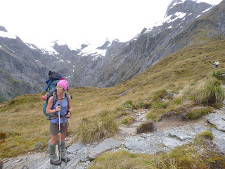
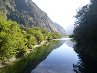
So, it's Christmas Eve, you just finished walking the Milford Track the previous day, the sun is shining and you're in Wanaka. What do you do?

Go walking of course!

We drove out to Raspberry Flat and walked up the Matukituki Valley for a day walk. The weather was perfect so it was a hot walk with little cover from the sun.
Matukituki Valley

Matukituki Valley

The track goes past the turn off to the Rob Roy Glacier pictured below.

Rob Roy Glacier

Rob Roy Glacier
Luckily we managed to find a shady spot to have our lunch. After lunch a couple of us carried out to Aspiring Hut which was another 15 - 20 minutes further on up the valley. In the photo below, the peak in the background on the right is Mt Aspiring.

Aspiring Hut


Aspiring Hut
Mt Aspiring from Aspiring Hut
After a long hot walk we had a swim in the Matukituki River down by the carpark before heading home and out for dinner.

Christmas Day was a perfect, scorching day in Wanaka and Queenstown with most of the day spent driving to Queenstown and back again.

Boxing Day was the day we set off for our climb on Mt Aspiring. We retraced our steps from Christmas Eve and headed up the Matukituki Valley but this time carrying heavy packs with our climbing gear. I made the decision to walk in wearing my climbing boots - that's a mistake I won't make again. Despite taping my feet I developed large blisters on my heels making the walk less than enjoyable. The plan for the first day was to walk up to French Ridge Hut. That involved walking up the Matukituki, past Aspiring Hut, across the river and then up the hill to the hut. On the surface that seemed like a simple, achievable plan. In retrospect, starting to walk in after 3pm wasn't the smartest choice.


From the valley floor we had a great view of French Ridge. The first part of the walk up to the hut is through bush. That was ok although some parts of the track were pretty rough and steep. Rest breaks were certainly needed.


After a while we came out of the bush into open tussock. At this point the sun was starting to go down and we were getting pretty tired. The weight of our packs didn't make the walk easy at all.

The photo below was taken as the sun was going down.

Mt Avalanche
We finally reached the hut at around 11pm. There were two other people asleep in the hut so we quietly had a snack (too tired to eat a proper meal) and got ourselves to bed. Tomorrow would be another hard day with the plan of climbing up to the Quarterdeck, crossing the Bonar Glacier and getting to Colin Todd Hut to position ourselves to summit Mt Aspiring the following day.
French Ridge Hut the next morning

Tuesday, January 15, 2013

Christmas holidays 2012 - part three

This post will cover off our time on the Milford Track. We were booked in to start the track on the 19th December and finishing on the 23rd. The weather forecast was looking decidedly iffy so I resigned myself to spending four days of walking in rain. The day we started the weather was brilliant so we drove to Te Anau Downs and caught the boat to the beginning of the track.

On the boat from Te Anau Downs.


The first day of the Milford is super-short - only an hour to get to Clinton Hut from Glade Wharf. The walk is all flat and mostly in the bush. We had a very brief swim in the Clinton River - brief because it was icy cold and the sandflies were rampant!

That night it rained pretty heavily and it was still a little drizzly the next day. We set out with jackets on etc but were able to dispense with those after a while and the day turned out just right for walking. The positive aspect of the overnight rain is that it kicked a lot of waterfalls into action. At first the waterfalls provided excitement but after the first 20 or so they all looked a little the same. Anyway, the day's walking was pretty cruisy and the scenery was fantastic.


Some cool looking fungi


Clinton River

The second night is spent at Mintaro Hut which is about 6 hours walk from Clinton Hut. We arrived at the hut, dumped our gear and headed up to Lake Mintaro for another very brief swim. Very refreshing! The keas cause quite an issue at Mintaro Hut. The hut has a policy that boots are not to be brought inside but the presence of keas there means you need to tie your boots together and then suspend them from a hook. This stops then ripping them to shreds in the night. All other gear must be brought into the hut to prevent damage.

The next day was the most strenuous of the walk (but was still pretty easy going) as you walk up to the top of Mackinnon Pass and then down the other side to Dumpling Hut. It's a 6-7 hour walk. The weather started out a little grey but improved through the day.


View at the top of Mackinnon Pass

Tarn on Mackinnon Pass

View on the way down from Mackinnon Pass


The photo below is of the Sutherland Falls. There is a side track that takes you closer to the falls but a slip that occurred last October has closed that track for the season. You can see the slip in the foreground. There is a still an area of loose rock near the top that DOC thinks could fall at any time. 


Our last day on the track was a gorgeous day. We made an early start to catch the first boat to Milford but had plenty of time for the walk, to stop and take photos, have a lunch break and then a swim at the end.

Arthur River


The end!

This is the slip that blocked the road out of Milford last year. They are still working on stabilising and clearing the slip. The road gets closed every night at present and also when it rains heavily.


Phew. What a long post. And tons of photos. There are still two more weeks of our holiday to cover so a few more posts to come.


Christmas holidays 2012 - part two

We had a couple of days in Wanaka before we were due to start walking the Milford Track. The weather was gorgeous so we figured we may as well go walking. On the 18th December we packed up a picnic lunch and went for a walk up the Motatapu Track to Fern Burn Hut. The walk took us over open farmland for a while. At one point there was great excitement when we saw a deer. The excitement soon dissipated when we then saw another dozen or so deer and realised we were on a deer farm. Soon we reached an area of beech forest where the track follows along a stream.


It was a nice walk through the forest and pretty easy going.


After a while you emerge out of the forest into an open valley of tussock. Here's a picture looking along the track with the hut in the distance.

After a relaxing lunch stop at the hut we turned round and headed back out to the car. The DOC estimates are 3-4 hours from the carpark to the hut. It didn't take that long. The track starts at Glendhu Bay and you can walk the 34 kilometres through to Macetown or even add on an extra 15 kilometres and walk to Arrowtown. 


The next day, 19th December, we did a short walk up Roy's Peak. We started the walk quite late in the day so didn't make it to the summit. We did make it to the ridge so had fantastic views.


Thursday, January 10, 2013

Christmas Holidays 2012 - part one


We're back from our three week holiday in the South Island and I have loads of stories to tell about our time away. I'll break up the holiday into a few separate posts to prevent them getting stupidly long.

We flew to Christchurch on the 15th of December and picked up our rental car. After loading our gear up and getting some groceries we headed to the beach before going to Sumner where a friend had offered us beds for the night.

After a fun evening and a good nights sleep we headed off towards the West Coast over Arthur's Pass.


On the way we called in at Cave Stream. Cave Stream is a short walk through a cave - walking upstream (Cave Stream isn't a particularly imaginative name). It takes about half an hour to complete the walk. Luckily for us it was a nice warm day so it didn't take too long to dry off and warm up afterwards. The water was up to waist deep in places but the walk itself was pretty easy. Before and after shots below.


After getting dried off we headed off to the West Coast to a DOC campsite at Lake Ianthe for the night. The campsite is wedged in between the main road and the lake - a little noisy from trucks going past but they seemed to be few and far between through the night.


The campsite costs $6 per night for each adult and $3 per night for each child. There are toilet facilities provided and the lake to swim in. The sandflies were rife of course (as they are almost everywhere on the West Coast of the South Island) to the point that I had to put a hat on to stop them biting my scalp. Nasty critters!

We all had a swim in the lake the next morning before packing up and heading down to Franz Josef glacier. We walked up to the glacier and had our lunch while perched on rocks - what a great view!


In the afternoon it was time to head to Wanaka over the Haast Pass. After an uneventful drive we arrived at our friend's place in Wanaka. The house has a terrific view of the lake and mountains. The photo below is from the front of the house.


The next instalment will cover a couple of walks we did around Wanaka and then our walk on the Milford Track. I'll get to work on that post and get it up soon. :)

Monday, November 26, 2012

Fun on Mt Ruapehu

In preparation for our planned trip to the South Island next month we headed up to Ruapehu to try a few things out - top of the list was to practise crevasse extraction. If the conditions are right to climb Mt Aspiring at Christmas time that will involve crossing the Bonar glacier. From what I've read the glacier can be quite heavily crevassed so there is a risk of falling down one. All well and good if you know the techniques of extraction so it was time to go do some practise.

We headed up to the Alpine Club lodge on Tukino on Saturday afternoon with the plan to spend Sunday on the snow. There had been some warnings about the volcanic status of the mountain over the past couple of weeks so we checked the latest news before heading up there. Apparently they've discovered that the crater lake is quite cool (20 - 25 degrees celsius) while the mountain underneath a few hundred metres down is extremely hot (800 degrees celsius). That is a sign that it could blow at some stage. Anyway, we checked out where the lahar paths are on the mountain and knew that the lodge itself is in a relatively safe location - of course if the mountain really blew big-time then the whole mountain could blow apart. From what I understand, the crater lake is behind and a little to the right of the snowy peak (Pyramid Peak) on the right side of the photo below.


As we are heading into summer I wondered what the snow cover would be on the mountain. Here's a photo I took when we got there on Saturday afternoon. Looks pretty good to me.


Here's a wider photo of the mountain. Pyramid Peak is just to the left of the middle of the photo.


We went for a bit of a walk when we got there to figure out where we could do our practise the following day. On returning to the lodge it was time for dinner and a good sleep. We had the lodge to ourselves - in fact it seemed we had that side of the mountain to ourselves.

In the morning we woke to a fine, calm day. In the distance we had a great view of Mt Ngauruhoe and to the right you can see a column of white. We're pretty sure that is steam coming from Mt Tongariro which erupted last week.


Here's a photo of the pulley system we setup. I was the lucky one who got to jump into the schrund (a bit like a crevasse) that was just below these rocks to test out the system.

And that's a picture of me at the bottom of the slope we were working on. The photo was taken about two thirds of the way down the slope.


After a fantastic day on the snow and in the sun we packed up and headed for home. The last photo is taken from the Desert Road looking back at Ruapehu and Ngauruhoe.