Wednesday, March 20, 2013

WOMAD New Plymouth 2013


We've just returned from our third WOMAD weekend. New Zealand's WOMAD event is held in New Plymouth each March and provides a eclectic mix of music and dance events. The festival runs from for three days - Friday afternoon till midnight, Saturday midday to midnight and Sunday midday to 11pm.

Crowd at the main stage
Along with thousands of others we camp at the racecourse which is next door to the Brooklands Park where WOMAD is held. After setting up our campsite we picked up our wristbands and programmes and spent some time planning which acts we would go to see. There are five stages running with performances generally running for an hour. It's not possible to see all acts so it takes a bit of planning to try and catch the ones you're most interested in. The first year we went we played it by ear and missed out on some great acts. We've got better at it!

This year the standout acts on Friday night were Hugh Masekala followed by Shunsuke Kimura and Etsuro Ono. After an enjoyable first evening we headed off to the campsite while Fly My Pretties were playing on the main stage. Saturday dawned bright and sunny and we had a lazy morning including a swim down at the beach before packing up some supplies and getting back to music listening / watching at midday.

We started the day with a fun performance from Newtown Rocksteady - great to see a Wellington bank performing and they got the crowd rocking. The next great act for the afternoon was The Correspondents from the UK. Their live act is great to see with Mr Bruce (the lead) dancing like a crazy man. The other act that we really enjoyed was Lau. These guys were billed as Scottish folk artists which didn't particularly appeal. In reality they were great - amusing, good music and fun.

Sunday dawned.... wet. Ugh! The weather forecasters were right for once. With jackets on and spare clothes we followed the crowd to get the final day of WOMAD started. For us the day started on the main stage with the Melbourne Ska Orchestra. Considering the weather was fairly rubbish these guys got the crowd jumping (watch the beginning of the video at the link I've provided and it was pretty similar to that).


Melbourne Ska Orchestra on the main stage (in the rain)
The other act that we particularly enjoyed was Abigail Washburn and Kai Welch. They were joined near the end of their act by the guys from Lau.

Abigail Washburn and Kai Welch with Lau on the Chimney stage

Our evening ended with a repeat performance from the Correspondents.

Of course there plenty of other performers who were very good. I've just mentioned the ones that were the highlights for us. After a great weekend of music / performance and a few drinks and yummy food we packed up camp on Monday and headed for home - in the rain.

Tuesday, March 19, 2013

Masala dosa

It's been a while since I've posted a food entry on my blog so here's one. I've had masala dosa a couple of times at markets / fairs and decided I'd try making them at home. Dosa is a fermented, gluten-free pancake that is a common breakfast food in Southern India. The masala bit is the filling. I scouted around on the internet as well as asked a guy who was making them at the market for his advice before heading off to an Indian supermarket (in Nelson St, Petone) to pick up some ingredients. You do need to plan ahead as the process involves both soaking time and fermenting time before you get to the cooking part. Here's the recipe and method I used for the dosa.

2 cups white rice
1 cup urad dal
1 tblsp chana dal
1/2 tsp fenugreek seeds

Soak all ingredients in water for 4-5 hours. I used my food processor to grind into a runny batter. The batter feels a little gritty but that's fine. Now comes the fermenting part. I left the batter to ferment for about 20 hours (in the sun room where it's nice and warm) but according to the recipe I used around 12 hours is ok.

With the dosa batter made I then prepared the following filling.

PotatoesOil
1/2 tsp urad dal
1 tsp mustard seeds
1 onion
4 curry leaves
1/2 tsp turmeric
2 green chillis
2 tsp fresh ginger, finely grated

Boil potatoes until tender. Crush lightly with a fork. In a pan, heat oil and add urad dal. Stir for a few seconds then add mustard seeds. Allow them to pop and then add curry leaves. Fry for 30 seconds. Add onion and cook for five minutes until the onion is translucent. Add turmeric, ginger and chillis. Mix well for 2 minutes. Make sure the liquid has evaporated and add the potatoes. Fold them in.

The usual way to cook the dosa is on a big, flat hotplate which I don't have. So I used our large cast iron frypan with some trepidation. I oiled the pan, got it nice and hot and poured the first measure of batter into the pan. Using the back of the soup ladle I spread the batter out and cooked it until brown and crispy (on one side). Normally at this stage you would add the filling, fold or roll the dosa and serve it to eat. I decided to cook all the dosa and let people fill their own at the table so I flipped each dosa and then piled them up in the oven to keep warm. Between each dosa I re-oiled the pan. While it was a little scary cooking the first couple they worked out really well, didn't stick to the pan and didn't fall apart.

While this meal took a long lead time to prepare it wasn't difficult and the dosa were easier to cook than I thought they would be. You could fill the dosa with all sorts of different curries. Try it sometime. It's delicious.

Monday, March 11, 2013

A trip to Arete and back

A great weather forecast at the beginning of February led to an overnight trip into the Tararua range with the goal to walk in to Arete Bivvy. The track starts out the back of Levin and we headed off up the Gable End track towards the tops. After walking for an hour or so I was feeling unwell and lacking in energy so we decided to carry on to Te Matawai hut and figure out what to do from there.

Gorgeous day for a walk

On the way to Te Matawai Hut

Te Matawai Hut
After a less than enjoyable trudge up to the hut the decision was made to have dinner and stay at the hut for the night. In the morning we would leave our packs at the hut, head up and over to Arete Bivvy before walking back out to the car via the South Ohau Stream. There were a few other people in the hut but after dinner it was time for an early night and a good sleep. The morning dawned fine with a little bit of cloud on the tops. While getting pack up ready to go I somehow managed to fall from the bunk steps onto the wooden floor. Luckily I have enough padding on my butt so the fall didn't cause any damage. We got ourselves packed up, sorted out gear and food for the walk up to Arete and headed off. While I felt a little better than the day before I was still not 100% so was walking slower than my normal pace. It was great to get up onto the tops and it didn't take us long to get to the high point of Arete and then descend down the other side to the bivvy.
On the way to Arete Bivvy

View along the tops

Arete Bivvy - cute little hut

Looking back down to Arete Bivvy - Wairarapa in the distance
The bivvy itself is a cute 2 person hut nestled in grass and tussock with one of those amazing loos with a view. After a rest break and a water topup it was time to get ourselves back to the hut to pick up our packs and start the descent down to the South Ohau Hut then down the stream to the car. I enjoyed the descent a lot more than I had enjoyed the climb so we made pretty good time going down. The descent down to South Ohau Hut is pretty steep and rugged. The hut itself is beside the stream and looks like a great place to stay. We decided we'd have to come back another time and spend a night there.

South Ohau Hut

View from in front of South Ohau Hut
We had a snack and a brief rest stop before entering the stream for the walk back to the car. Unfortunately, we had only walked for about 10 minutes when I slipped on a rock and landed heavily on my butt. It was one of those awful moments when you realise you've done some real damage and that the rest of the day would be a little different than planned. After dumping my pack off my back and gingerly getting to my feet (I was dry I might add - somehow I landed right on the flat, dry rock that I had slipped off) I knew that I had managed to damage something pretty badly but that I could still walk. After swapping some gear out of my pack to lighten the load we set off down the river towards the car. Pretty much every step was agony with any climbing over rocks intensifying the pain. I did wonder if I had lost enamel from my teeth from all the teeth-gritting that was going on. It was definitely no fun and there was little to no conversation going on during the walk out. It took about 4 hours to walk out to the carpark where we then had the drive home to cope with.

South Ohau Stream

South Ohau Stream


South Ohau Stream
A trip to the doctor the following morning and an xray a couple of days later revealed a displaced fracture of the sacrum. On looking that up on Dr Google it looked like a scary proposition but it seems that it all depends where the break is as to how serious the fracture is. Mine is right at the bottom of the sacrum - just above the coccyx - which is, apparently, far less serious than breaks higher up. It still means a healing time of 6-12 weeks, up to 3 months off my bike and all other physical pursuits are on hold for now. This makes for a very bored Carolyn with the prospect of not being able to get out and about for a while.

Tuesday, March 5, 2013

Hillary Trail - Wellington Anniversary Weekend

The opportunity arose to be in Auckland over Wellington Anniversary Weekend this year so I scouted around to see what we could do with that time. I stumbled across the Hillary Trail which is a 70km, 3-night walk from the Arataki Visitor Centre to Murawai.We only had three days (2 nights) available so arranged to leave the trail early at Piha Beach. Information on the trail was readily available on the internet but warned that the walk was a hard, long walk.

Day 1 - Arataki Visitor Centre to Whatipu

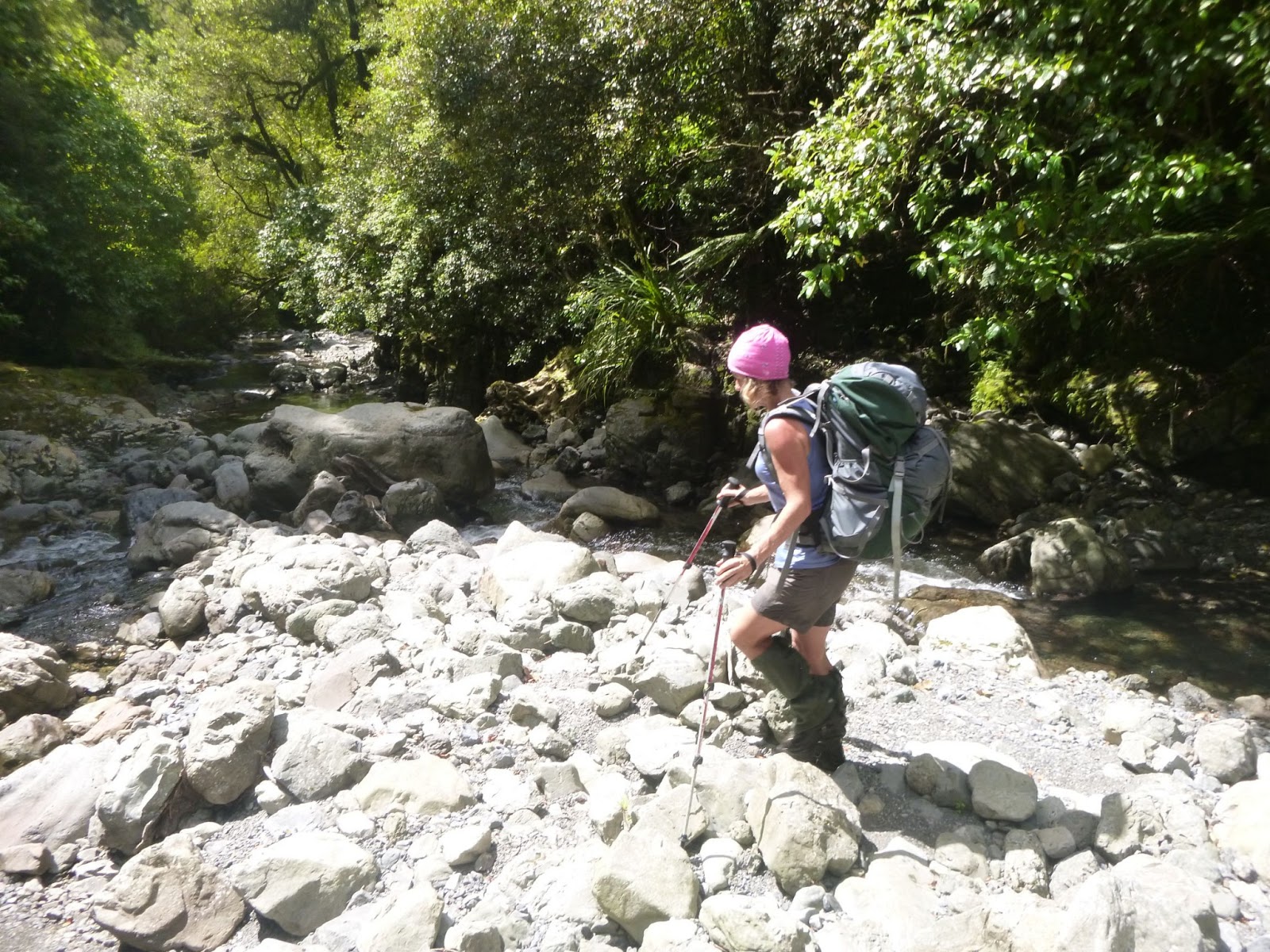
We fronted up to the Visitor Centre at about 11am on the Saturday morning and set off to Karamaratura (just past Huia) which was a 10km walk.


This part of the trail had warnings about the boggy nature of the track and was expected to take 4-5 hours to get to the campground. The track itself was fine. Slightly boggy in places but certainly better than some areas of the Tararuas as far as mud went. After an enjoyable walk we arrived at the campsite at 2pm - it only took us 3 hours to get there. We stopped at the campground for lunch and then figured we may as well keep walking for a few more hours (another 10kms) and head to Whatipu for our first night.

Part of the track between Karamaratura and Whatipu

Trying to get phone reception on the hill above Whatipu (a little windy up there)
Picture looking towards Whatipu and the entrance to Manukau Harbour
We arrived at Whatipu late afternoon and set up camp at Cave campsite. This was a very small camp ground that provided a small number of tentsites and a toilet. There was fresh water available about 15 minutes walk away at the main Whatipu campsite. There were a number of people already at Cave campsite when we got there so it was a little tricky finding some flat ground to set up camp for the night.

Just enough room for a small tent at Cave campsite
We got that sorted and then had dinner just before the sun went down. A very enjoyable first day on the Hillary Trail.
 
Sun setting at Cave campsite

Day 2 - Whatipu to Craw campground

 Day 2 dawned a little wet and miserable so we packed up our tent and headed into one of the caves nearby to have breakfast.
Breakfast spot in the cave
From here our destination was Craw campground just north of Piha, a walk of 21.5kms. Today would be a mix of walking in the bush and then on the beach to Karakare before enjoying a with a little bit of civilisation at Piha. Luckily the weather cleared up and the day turned out warm and sunny. After a little while we reached Pararaha campground which is where we had intended to camp on our second night. Clearly we were walking the trail a little quicker than the signposted times. We managed to get within cell range to change our plans of leaving the trail early and sort out a pickup from Murawai instead of Piha. Along the way we walked through the Tunnel Grove campground. This was an awesome spot and, if we'd known about it, we would have arranged our walk to stay there.
Tunnel Grove campground
The tunnel by the campsite complete with the abandoned boiler which didn't fit through the tunnel


From that campsite the walk continued along the beach all the way to Karekare. Rather hard work walking in sand with a pack on. At Karekare we climbed a small hill to where the Hillary Trail continued and sat and had lunch in the sun.

Beach at Karekare
View from our lunch spot at Karekare
After lunch at Karekare we headed back into the hills and came across Mercer Bay. We noticed a group of guys ziplining across the top of this bay so we stopped to watch them for a while.

Mercer Bay
From Mercer Bay we carried on towards Piha where the trail winds its way past the Kitekite Falls.This was a popular spot for families swimming.
      
Kitekite Falls at Piha
After a brief photo stop we headed into Piha where we had a well-deserved icy cold cider before carrying on to Craw campground.
Beach at Piha - Lion Rock in the middle of the photo
Campsite at Craw campground
There were a couple of guys camped here who were also doing the Hillary Trail. They had decided to exit early though and not do the final day through to Murawai. We had a pleasant night here with an early start the next morning. The information on the trail said that the walk from Craw to Murawai would take 11-12 hours. With a 5:30pm pickup from Murawai organised we figured we should get an early start so headed off at about 7am.

Day 3 - Craw campground to Murawai

From the campground we headed over farmland for a while before the trail went back into the bush heading away from the coast for a while. After a long descent we walked alongside Lake Waimanu and then some huge sand dunes to Bethells Beach (Te Henga).

Lake Wainamu
At Bethells Beach we continued on the trail but had a great view down to the beach where some filming was taking place. Not sure what the film is but there were horses and what looked like Roman soldiers involved.


Bethells Beach - Te  Henga
After a short climb over the hill by Bethells Beach we stopped for a swim at O'Neills beach. The sea looked a little treacherous here but it was great to have a dip and wash off some of the accumulated sweat and dirt from the previous two days.
Te Henga Walkway - O'Neill Bay
After our refreshing swim we carried on. We were now on the Te Henga walkway to Murawai.
Te Henga Walkway - from Bethells Beach to Murawai
Somewhere towards the end of the walkway we stopped on the side of the track for a lunch break. We were making good time so were confident we would easily get to Murawai in time for our pickup at 5:30pm. After lunch we carried on to the end of the Te Henga trail - the last part of the trail to the road into Murawai climbs a series of wooden steps. Not the sight you want to see after having walked a decent distance already. Once we finished climbing the steps we were onto a mix of road walking (boring and hard on the legs) and trails through the bush. This took us through to the gannet colony and then onto the beach at Murawai. We celebrated our arrival with a swim in the surf there. It felt great! Once we were suitably refreshed we made our way to a cafe for a cold drink while we waited for our ride. All up the day had taken us about 9 hours - including stopping for a swim and a relaxed lunch break as well as numerous photo stops along the way.

Small part of the gannet colony at Murawai

Summary

We enjoyed our three days walking the Hillary Trail. From our perspective, the numerous warnings about how rough, tough and long it was were overstated. The track was pretty dry when we walked it so I can imagine after (or during) rain progress could be a little slower. There are certainly improvements that could be made to the trail and the literature. Signage was either over the top with Hillary Trail markers very close together to non-existent where no Hillary Trail markers could be seen and no other useful signage to indicate the start of tracks. Carrying the detailed brochure as well as a detailed map for the area assisted us in a few places where the route was unclear. The estimated times were overstated for the pace we were walking. Given that we were carrying reasonably heavy packs with camping and cooking gear, etc I don't think we were walking particularly fast.The maps for the trail show the route between Pararaha to Karekare is in the hills but the markers have that section walking along the beach. There was no information provided on that change and no mention of it at the visitor centre at the beginning of the trail. It would be good to have more information in the brochure about some of the other campsites and maybe a breakdown of the times between different sections of the walk. And my last point was to not take much notice of the profile map in brochure. The profile for the whole 70kms is printed across the page resulting in an unhelpful profile that doesn't show any details. It would be much better for the profile to be split for each section of the trail and to be printed in landscape.